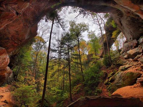
Grays Arch
| Route 66 | Cities | Beaches |
|
Grays Arch |
|
| Auxier Ridge | Martins Fork | Grays Arch | Rush Creek | Pinchemtight | KoomerRidge | ChimneyTopCreek | ParchedCornCreek | SwiftCampCreek |
| IndianStaircase | Castle Arch | Osborne Bend | Raven Rock | Red Byrd Arch | Indian Creek | Revenuers Ridge | Copperas Falls |
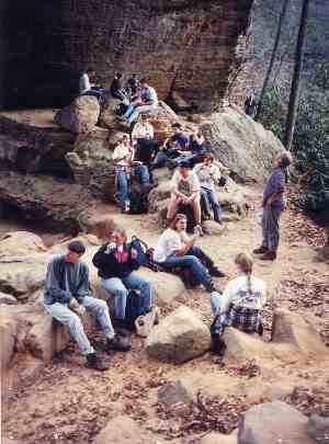 |
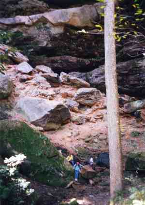
The Grays Arch Hike is not long but it's very scenic. It's a loop. You hike out along one level ridge, descend some very steep stairs, scramble across a rockfield, possibly climb a nontechnical rock formation, climb a very long very steep hill, then hike out along another level ridge. You'll see a beautiful forest, a spectacular natural bridge (one of the largest east of the Mississippi), a beautiful stream valley, and some impressive boulders filled with iron rings and overgrown by trees whose roots wrap around the boulders. Grays Arch is a great place for a long lunch. You'll have two water sources on this hike. One is the waterfall adjacent to Grays Arch, the other House Rock Creek (also known as Kings Creek), the stream you cross before heading up Fingernail Hill. However, if you leave the Grays Arch Trailhead with two full bottles of water, you should be fine. You're in shade the whole way and the only place you'll be drinking lots of water is the climb up Fingernail Hill. Plan on eating lunch at Grays Arch. It's exactly halfway and there are lots of rocks and ledges to perch on. The photo at left shows a student group enjoying lunch at the arch. You're not likely to ever see this many people there at one time. They're sitting directly under the arch.
|
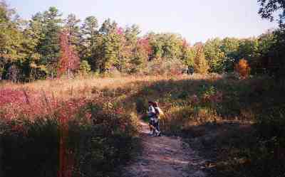
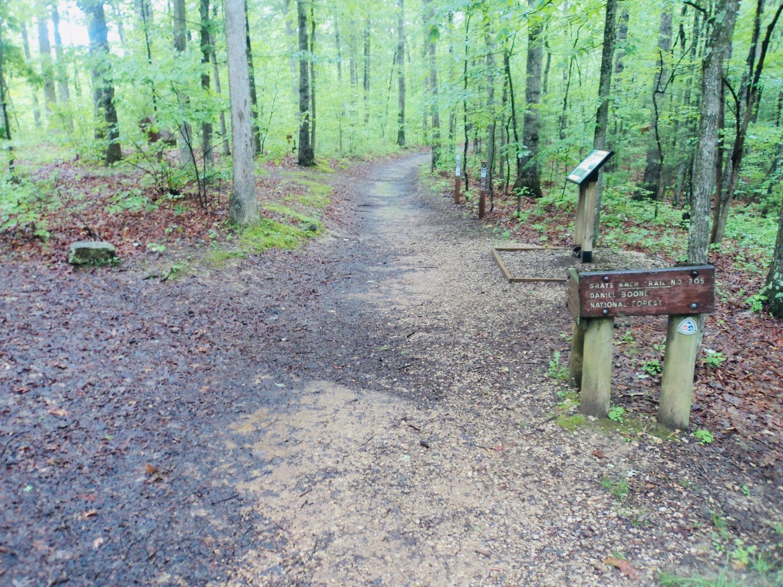
The Grays Arch Trailhead is on Tunnel Ridge Road. As you come off the Mountain Parkway at Slade, turn left, go under the parkway, then turn right on highway 15, drive 3.5 miles, and begin looking for the gravel Tunnel Ridge Road turning off to your left. Follow it one mile to the Grays Arch trailhead on your right. It has portajohns, picnic tables and drinkable water. Once you begin hiking, you'll come to an intersection. Bear to your right and walk about 100 yards to a large clearing. If a fire or high wind created such an opening, it would go through a succession cycle and return to young forest in several years. This one seems frozen in the third year of succession; it has six foot tall canopy annuals like Joe Pye Weed and Ironweed, various berry bushes, and tall grasses. 100 years ago, this was a staging site for the timbering operation that stripped most of the trees from the Gorge. They parked their heavy horsedrawn equipment here, maintained tent offices for foremen, and stacked supplies. In doing so over 40 years, they compacted the soil so tightly trees have not been able to grow here. As the annuals and biannuals loosen up the soil, the trees will eventually return. |
 |
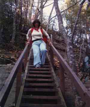 |
You'll first see Grays Arch from a railing on your right. Suddenly you come to this long, steep flight of stairs. Be careful. This is a damp, humid valley and the stairs can be very slippery. At the bottom of the stairs, turn right to the arch. The trail will dip sharply down below a high, narrow waterfall (which may be dry in August and September), then switchback up to the arch. Adventurous hikers may wish to climb the debris field below the 50 foot waterfall (photo below). It consists of boulders and large rocks that have fallen as the ledge above collapses. At the very top they'll come to a shelter extending back behind the falls. It's usually pretty wet back there, but on hot, humid days it's also usually cool and refreshing. You could also leave the trail and scramble up the giant rockpile, work your way to the left, and come out under the Arch precisely where the trail comes up. |
Grays Arch itself is 79 feet across, making it one of the largest in the Gorge. But the lip of the waterfall is 40 feet across. So the total span is an impressive 119 feet. Grays Arch is larger than the much more famous Natural Bridge. It's 50 feet tall. It's also the only arch in the Gorge area with live trees growing on top. Technically, Grays Arch is a buttress arch, the only one in Kentucky. A buttress arch is an arch extending from a ridge across to an isolated pier of significant size. Large as it is, it's hard to believe that Grays Arch was "lost" for over a decade. The loggers that pulled out in 1920 kept saying one of the largest arches in the Gorge was near Tunnel Ridge Road between Martins Fork and Rush Branch. Rough Trail did not exist then. Repeated attempts to find the arch failed. Finally, in 1930, Dr. Carl Clark of UK spent the entire Summer searching and finally found it. As you sit at Grays Arch and look around keep in mind photographs show not one tree standing in 1920. Thr entire House Rock Creek (Kings Branch) valley had been timbered out. Only stumps remained. So the forest you now see is 100 years old. Because of the waterfall, this little enclave is always humid and a great habitat for Ferns, Mosses and Fungi. |
 |
.jpeg) |
The slightly orange tinge to Grays Arch is due to slight iron sediments. As you hike on down the main trail, you come to huge boulders with heavier deposits in swirls. This is an arch not a bridge becaue there is currently not a stream running underneath. Grays Arch is composed of cross bedded, fluvial quartzite known as the Corbin Sandstone. Back when this land was underwater, a huge amount of sediment was washed down over it by a large prehistoric river flowing from the north. Then the tectonic plate carrying the delta drifted north and rose, leaving the high rocks open to erosion. But this area back then received much more rain and had much larger streams and rivers. Local streams today don't have enough flow to carve out these valleys and arches, but long ago they did. Even back in the 1800s local rivers and streams were bigger. Riverboats used to dock in down town Lexington on Town Branch. Today Town Branch is a small stream flowing through pipes below Vine Street. To see photos of those riverboats docked in Lexington, go to the UK Administration Building. |
| Leaving the arch, retracing your steps back the staircase but continuing on straight, you'll hike down past boulders as big as houses. The reddish brown swirling patterns in the rocks are iron deposits. They created a brief iron furnace boom in Kentucky, but the iron was not concentrated enough to be competitive with the greater deposits elsewhere, and the boom was short lived. | 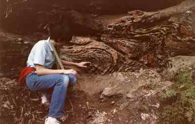 |
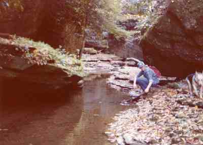 |
Eventually you'll come to House Rock Creek (sometimes referred to as Kings Creek). If you left the trail and bushwacked downstream, you could look up at Rush Ridge to your right. You could see a slight saddle in that ridge. You can work your way uphill to that saddle, cross through it, and drop down into the next valley. From the saddle in Rush Ridge, if you look straight across to the East, you will see a very definite gap in the next ridge. That is Pinch Em Tight Gap. You could bushwack your way across to that, and drop down into Adena Meadows below Chimney Top Rock. This is one of the favorite off trail routes in the Gorge. If you left the trail and bushwacked upstream, you would come to a headwall cirque and a great secluded campsite. It's just below Tunnel Ridge Road, but the cliffs are high and sheer, so the only access is the way you came. However, most hikers cross the stream, find the trail on the other side, and start up.
|
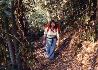
Fingernail Hill is the longest and steepest climb in the Gorge, which is saying something since the Gorge is one long, steep climb after another. Especially if this is one of your first hikes of the season, you'll be stopping for breath frequently. In the Spring or Fall, in the cool, crisp air, this can be invigorating. But in the intense heat and humidity of Summer, Fingernail Hill can be a miserable climb. There are no panoramic views to enjoy, but you are on a vast forested hillside. Black Bear frequent this area. There have been several sightings and two confrontations in recent years. If you have a dog along, this would the place to leash it. You'll hear other scurrying noises as you climb. These are Fence Lizards, Skinks, Voles, Fox, Raccoons, Squirrels, Chipmunks and various ground birds. The trail switches back twice, climbs 17 and 20 wood steps, and levels out on Rush Ridge. |
 |
 |
This trail intersection would be a good place to pause for a snack after that long ascent. There's a trail dropping off to the left, heading over to Pinchemtight Ridge, but ignore this and follow the level ridgetop for two miles. This ridgetop forest features oak, hemlock, elm, sassafras and rhododendron. Looking back ro your right, you can also find great distant views of Grays Arch. After a pleasant two mile stroll you'll emerge onto Tunnel Ridge Road. Turn right to return to the Grays Arch Trailhead parking lot. Depending on how much you walked around at Grays Arch, you will have come about 4-5 miles. |
|
|||
|